Custom 4
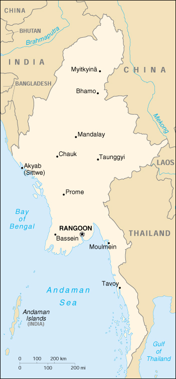
About Myanmar
Location: Southeastern Asia, bordering the Andaman Sea and the Bay of Bengal, between Bangladesh and Thailand
Geographic coordinates: 22 00 N, 98 00 E
Map references: Southeast Asia
Area:
total: 678,500 sq km
land: 657,740 sq km
water: 20,760 sq km
Area - comparative: slightly smaller than Texas
Land boundaries:
total: 5,876 km
border countries: Bangladesh 193 km, China 2,185 km, India 1,463 km, Laos 235 km, Thailand 1,800 km
Coastline: 1,930 km
Maritime claims:
contiguous zone: 24 nm
continental shelf: 200 nm or to the edge of the continental margin
exclusive economic zone: 200 nm
territorial sea: 12 nm
Climate: tropical monsoon; cloudy, rainy, hot, humid summers (southwest monsoon, June to September); less cloudy, scant rainfall, mild temperatures, lower humidity during winter (northeast monsoon, December to April)
Terrain: central lowlands ringed by steep, rugged highlands
Elevation extremes:
lowest point: Andaman Sea 0 m
highest point: Hkakabo Razi 5,881 m
Natural resources: petroleum, timber, tin, antimony, zinc, copper, tungsten, lead, coal, some marble, limestone, precious stones, natural gas, hydropower
Map of Myanmar (Burma)